 Big data, machine learning, deep learning, and artificial intelligence (AI) are some of the most commonly used buzz words in the technology industry over the past decade, and rightfully so. Advances in machine learning and AI have led to unprecedented opportunities and advancements across numerous industries. Whether it’s the recommendation system in your favorite streaming platform, the facial recognition on your smartphone, or your SUV’s park assist feature—these technologies permeate our daily lives.
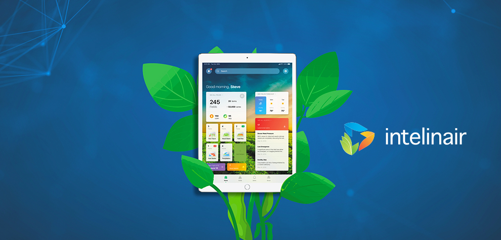
The agricultural industry is no different. At Intelinair, we are delivering insights and intelligence to the agricultural industry at scales previously unimaginable. We use cutting-edge machine learning and computer vision approaches to identify key patterns in high-resolution aerial imagery of fields. These patterns fuel our “Alerting Engine” which delivers timely smart alert notifications through our flagship platform, AGMRI, to farmers via their phone, tablet, or desktop, allowing them to see issues, such as weeds, standing water, nutrient deficiency, and more before they negatively impact yield. All of this can be done at a glance, no matter where you are.
While machine learning methods are impressive in their own right, to truly deliver value they need to be used to solve the right problems. Technology doesn’t exist in a vacuum. Problem formulation is key: mapping grower and retailer needs into the right machine learning problem to be solved is central to delivering ROI to our customers. We work closely with our farmer customers and retailer partners to solve the most challenging problems and deliver timely intelligence to them.
A while back, I had the opportunity to meet with one of our farmer customers at his Illinois farm. He took us up to the top of one of his grain bins where we could see his farm, the neighboring farm he also managed, and off in the distance, his parents’ farm in the next county. He told us that before AGMRI, this was how he scouted his fields and prioritized his decision making. And, while the view was impressive, it was naturally limited: at best, he had a partial view of a few adjacent farm fields.
Now with our platform, AGMRI, he can see in a glance which of his fields are experiencing issues around emergence, weeds, fertility, weather, and more. One field, 100,000 fields, it doesn’t matter—all of the information is extracted automatically with artificial intelligence. This intelligence is delivered to the farmer in a clean, curated manner to help make the best possible management decisions for the greatest return on investment in both time and money.
Let’s take a closer look at how this works.
At Intelinair, we collect and ingest remotely sensed data from satellite, airplanes, and drones multiple times over the course of the growing season to get an evolving view of each field. This imagery is combined with other sources of information including equipment data, soil maps, and topography. These data sources create the foundation of our Digital Twin, a virtual model which captures all the important features and properties of the field throughout the season.

We then run numerous computer vision, deep learning, and machine learning models to detect relevant patterns in the imagery. These patterns feed our alerting algorithms to deliver timely intelligence and insights throughout the season. Some of the alerts offered at each stage of the growing season include:
- Planting: regions which have failed to emerge fully are identified and a custom replanting prescription can be pushed to directly sync with a farmer’s
- Early Season: weed density is mapped across the field and can be synced with equipment to enable precise herbicide treatment.
- Mid-Season: alerts of nutrient deficient areas to treat the issue at the onset.
- Mid-Season: diseases are identified for priority scouting and treatment.
- Harvest: regions of variable drydown are flagged to help time harvest.
Our crop intelligence platform enables this to be done on a massive scale. By flying 13 times over fields, in 2021 alone we collected more than 500 terabytes of imagery, across more than 100,000 fields over nearly 5 million acres in size. From this data, we generated more than 900,000 smart alerts to help farmers identify issues in their field to inform their management decisions.
The sheer magnitude of this data is important because while we use a variety of tools from computer vision to machine learning, at the core of our intelligence platform are a number of deep learning algorithms which drive superior performance. This combination of Big Data and Deep Learning is key. It’s not just buzz. Older methods like heuristics, and even traditional ML/CV algorithms, have a fixed performance ceiling. They can’t learn. They make the same mistakes over and over again. In contrast, deep learning algorithms have an unquenchable thirst for data. More data leads to better performance which leads to more data, generating a “cumulative advantage,” meaning models get better over time. Additionally, deep learning enables economies of scale which allows algorithms to be extended and updated more quickly and for a much lower cost.
What does this mean to our farmer customers and retail partners? It means better algorithms that improve in performance over time, and the ability for us to deliver new features to you faster. Big data and deep learning were meant for each other. And, at Intelinair, we have both.
Big Data, Machine Learning, and AI aren’t just buzzwords to us. It’s what we’re made of. At Intelinair, we’re using these technologies to drive the future of agriculture and help farmers boost their productivity and maximize efficiency.
About IntelinAir, Inc.
IntelinAir, Inc., the automated crop intelligence company, leverages AI and machine learning to model crop performance and identify problems enabling commercial growers to make improved decisions. The company’s flagship product, AGMRI® aggregates and analyzes data including high resolution aerial, satellite, and drone imagery, equipment, weather, scouting, and more to deliver actionable Smart Alerts on specific problems in areas of fields as push notifications to farmers’ smartphones. The proactive alerts on operational issues allow farmers to intervene, rescue yield, capture learnings for the next season, and identify conservation opportunities for sustainable farming. Annually IntelinAir analyzes millions of acres of farmland, helping growers make thousands of decisions for improved operations and profitability. For more information, follow IntelinAir on LinkedIn, Facebook, Twitter, and Instagram and visit https://www.intelinair.com/.
®Trademark of IntelinAir, Inc.
#AgMRI #Intelinair #RowTracer #WeedWatch #HeatSeeker #TrendZone #YieldRisK #HelpingFarmersProsper #TransformingGlobalAg

