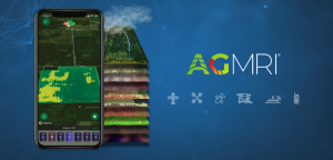
INDIANAPOLIS & GOTHENBURG, SWEDEN – July 27, 2023 – Intelinair announced today a multi-year collaboration agreement with Solvi to further expand its AGMRI platform by providing corn and soybean growers proven and reliable stand counts for the early crop growth stages.
“By combining our suite of drone image collection and analytics with Solvi’s advanced plant-counting algorithms, our new service will further expand our offering in plant population inspections,” said Tim Hassinger, CEO and President of Intelinair. “Through this collaboration, we can provide timely and highly accurate stand counts via our TrueCause™ drone scouting tool on anything from research plots to large operations.”
The following principles have been applied to Intelinair’s expanded offering:
- Data-mined. TrueCause™ intelligent drone mission planning and stand counts visualization taps Solvi’s AI-powered image classification models that quickly analyze large, complex datasets. These algorithms recognize and predict plant architecture patterns for fast, reliable insights.
- Accurate. Plant Count models were trained on corn and soybean fields to recognize geolocated crop nuances, especially in critical early growth crop stages, supporting most planting configurations, including twin rows.
- Relevant. The system delivers the actual stand for yield potential, as well as predicting replant units needed in a timely manner for replanting seeding prescriptions.
“Our Plant Counts tool, powered by PlantAI™, accurately identifies, counts, and classifies acres of plant shapes from done images in minutes,” said Igor Tihonov, CEO of Solvi. “While the technology behind the scenes uses sophisticated AI algorithms exclusively trained on thousands of agricultural images, Intelinair’s user interface simplifies the entire process for complex workflows or large commercial operations.”
For more information on how to simplify plant counting on your operation or schedule a demonstration, go to agmri.com or email sales@intelinair.com.
About Intelinair
Intelinair elevates agronomic management decisions by providing insights all season long to farmers and ag retailers through its easy-to-use interactive platform AGMRI. High resolution aerial imagery from fixed wing airplane, satellite, or drones provides whole field views increasing efficiency by prioritizing fields and offering assurance that fields are monitored and reviewed for timely decision making and identifying sustainability opportunities. Intelinair analyzes millions of acres in the U.S. and several other countries from its headquarters in Indianapolis, Indiana. Take action through informed management decisions at agmri.com.
About Solvi
Solvi helps researchers, agronomists and growers worldwide assess and monitor virtually any crop throughout the growing season using drone-based imagery analytics. Solvi’s advanced yet easy-to-use suite of tools provides actionable plant-level insights for large-scale production fields to agricultural research plots. Learn more and sign up for a free trial at solvi.ag.
™TrueCause – Trademark of IntelinAir, Inc.
™PlantAI Trademark of Solvi
®Trademark of IntelinAir, Inc.

