Intelinair Closes $3.5 Million to Bring Automated Aerial Imagery Analytics to Farmers
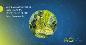
SAN JOSE, Calif. (September 14, 2016)—Intelinair, Inc., today announced it has closed its series seed funding comprised of $3 million in equity and $500,000 in venture debt. Intelinair is an aerial imagery analytics company whose AgMRI™ solution provides farmers with a comprehensive health analysis of their farms by combining high resolution aerial imagery analytics, advanced agronomic sciences, and proprietary algorithms derived from traditional computer vision and deep learning methods.
“Experts estimate demand for food will nearly double by the year 2050 as the world population grows to 9-10 billion people. Simultaneously, available farmland will shrink due to climate change and alternative uses for the land—for example, housing,” said Al Eisaian, Intelinair co-founder and CEO. “In addition, the average age of the American farmer is 57 and growing, and fewer younger people are choosing farming as a career. With fewer resources to meet bigger demand, humanity has to use modern technologies and data-driven methods for producing food more efficiently. Intelinair is excited to be part of the innovation ecosystem, focused on helping farmers to sustainably produce more from every acre. This funding will help us bring these vital new solutions to farmers through our partnerships with their trusted advisors.”
Participants in this round of funding included Hyde Park Venture Partners, Western Technology Investments, Harvard Business School Angels of Chicago, Holdsworth & Company, HiveFund, and several angel investors. Several veteran ag industry executives and large farmers also participated.
“A significant percentage of this funding round came from individuals who are deeply knowledgeable of the global agriculture industry. Having this level of backing from leaders who really understand the solutions needed in today’s environment and the impending era of digital agriculture confirms to us that we’re on the right path to delivering truly remarkable solutions to the agriculture community,” Eisaian said.
Hyde Park Venture Partners Managing Director Guy Turner said, “We have been active investors in digital agriculture companies that are transforming agriculture as we know it. Intelinair’s proprietary computer vision technologies, deep learning methods, and cutting-edge agronomy were key drivers in our decision. We were impressed by the depth of the science and technology team at Intelinair; and knowing Intelinair was founded and led by Al Eisaian, a seasoned technology entrepreneur with multiple successful exits, gave us additional confidence to invest.”
Intelinair is a San Jose, California, and Champaign, Illinois-based startup co-founded by serial technology entrepreneur Al Eisaian, along with Greg Rose, VP of Product, and Naira Hovakimyan, Chief Scientific Officer and professor of Mechanical Science and Engineering at the University of Illinois. In 2015, its founding year, the company was awarded a National Science Foundation grant of $150,000 for aerial weed detection in conjunction with UIUC. The company has been working with world-renowned scientists in aerial imagery, computer vision, deep learning and agronomy from several universities, including the University of Illinois, North Dakota State University, Oklahoma State University, University of Hawaii, and UCLA.
Eisaian said, “Ag-MRI™ is the ultimate cost-effective and comprehensive ground-truthing solution for farmers and their agronomists and consultants, validating the farmer’s knowledge with data from the field and employing powerful algorithms to synthesize the data into useful information to drive decisions—and do it while there’s still time to make adjustments to boost yields and control input costs for the current growing season.”
About Intelinair
Intelinair, Inc., is an aerial imagery analytics company focused on agriculture that delivers actionable intelligence to help farmers make data-driven decisions to improve operational efficiency, yields, and ultimately their profitability. Intelinair combines the power of aerial imagery analytics through traditional computer vision and modern deep learning methodologies, agronomic science and user-friendly interface (mobile) technologies to deliver near real-time decision support to farmers. The company’s flagship solution Ag-MRI™ is a field health monitoring and early-warning system that enables farmers to manage their operations proactively and with confidence. The company, founded in 2015, has dual headquarters in San Jose, Calif., and Champaign, Ill.

