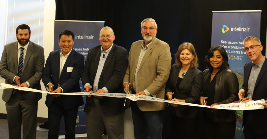
INDIANAPOLIS (April 21, 2022) – Governor Eric J. Holcomb joined local officials and executives from Intelinair, an agbioscience company, today to celebrate the grand opening of the company’s new headquarters in Indianapolis, which will support up to 100 new, high-wage jobs by the end of 2025.
“Indiana is committed to creating an environment that attracts startups like Intelinair to grow operations while continuing to grow agtech solutions geared toward an economy of the future,” said Gov. Holcomb. “This investment will further strengthen Indiana’s position as a top agricultural state and help attract a diverse talent pool.”
The company, founded in 2014, was previously based in Pasadena, California, and is relocating its headquarters to Indianapolis to be closer to its customer base, join the city’s tech industry and tap into the area’s base of agtech talent. Located at 9510 N. Meridian St., the company is hiring agronomists, software engineers and developers, adding to the current 16 employees in Indiana and eight in Illinois. Interested applicants may apply online.
“We selected Indianapolis for a number of reasons,” said Tim Hassinger, CEO and president of Intelinair. “First, Indiana’s thriving business environment with access to both ag and tech talent who either already reside in the state and those graduating from area universities. The move also brings us closer to our farmer and channel partner customers. Early in our process, it became clear that Indianapolis was the right fit for Intelinair, and we look forward to being part of this community.”
Intelinair uses artificial intelligence and machine learning to analyze high-resolution aerial imagery from aircraft, satellites and drones. The company recently announced the launch of AGMRI Enterprise, a new service that has been designed specifically with ag retail customers in mind. AGMRI Enterprise provides a current view of what is happening in customer fields with regularly scheduled flights throughout the season. The AGMRI® and AGMRI Enterprise platforms are supported by in-season aerial imagery from aircraft or satellites.
Earlier this year, the company also announced a collaboration with Jacobs to provide a scalable, high-grade multispectral sensor systems and aerial imagery services, while Intelinair provides its artificial intelligence (AI) powered crop analytics AGMRI® platform to deliver a complete view of every acre, every field from planting to harvest.
The Indiana Economic Development Corporation (IEDC) partners with industry organizations like AgriNovus Indiana, the state’s initiative dedicated to promoting and accelerating the growth of the agbiosciences community, in order to target business recruitment in high-skilled, high-growth sectors. AgriNovus works to cultivate business development needs within the agriculture sectors, helping recruit organizations like Intelinair to expand or locate in Indiana.
“Agtech is the fastest growing category of Indiana’s $52 billion agbioscience economy,” said Mitch Frazier, president and CEO of AgriNovus Indiana. “Our proven strength in software as a service coupled with our deep expertise in production agriculture make Indiana the destination of choice for companies like Intelinair to innovate, scale and serve producers around the world.”
Based on the company’s job creation plans, the IEDC committed an investment in Intelinair of up to $2.5 million in the form of incentive-based tax credits. These tax credits are performance-based, meaning the company is eligible to claim incentives once Hoosiers are hired. The city of Indianapolis supports the project in partnership with Develop Indy, the economic development organization for the city of Indianapolis and Marion County.
“Intelinair joins a fast-growing local tech landscape, as Indianapolis has in recent years welcomed dozens of firms—from startups to global leaders—all using data and advanced tech to enhance our lives in a changing world,” said Indianapolis Mayor Joe Hogsett. “As our nation’s crossroads, and as a midwestern capitol, our city offers a lot to Intelinair as they seek to reach America’s farmers. And Intelinair offers a lot to Indianapolis, as they look to hire 100 high-wage positions and excel as another strong player in our thriving business ecosystem.”
About IntelinAir, Inc.
IntelinAir, Inc., is an automated crop intelligence company that leverages AI and machine learning to model crop performance and identify problems enabling farmers to make improved decisions. The company’s flagship product, AGMRI® aggregates and analyzes data including high resolution aerial, satellite, and drone imagery, equipment, weather, scouting, and more to deliver actionable Smart Alerts on specific problems in areas of fields as push notifications to farmers’ smartphones. The proactive alerts on operational issues allow farmers to intervene, rescue yield, capture learnings for the next season, and identify conservation opportunities for sustainable farming. Annually Intelinair analyzes millions of acres of farmland, helping growers make thousands of decisions for improved operations and profitability. Follow Intelinair on LinkedIn, Facebook, Twitter, and Instagram and visit intelinair.com or AGMRI.com.
About IEDC
The Indiana Economic Development Corporation (IEDC) is charged with growing the State economy, driving economic development, helping businesses launch, grow and locate in the state. Led by Secretary of Commerce Brad Chambers, @SecChambersIN, and governed by a 15-member board chaired by Governor Eric J. Holcomb, @GovHolcomb, the IEDC manages many initiatives, including performance-based tax credits, workforce training grants, innovation and entrepreneurship resources, public infrastructure assistance, and talent attraction and retention efforts. For more information about the IEDC, visit iedc.in.gov.
®Trademark of IntelinAir, Inc.

